
I took a short walk to a small pond known as Peter's Pond which had great reflections.

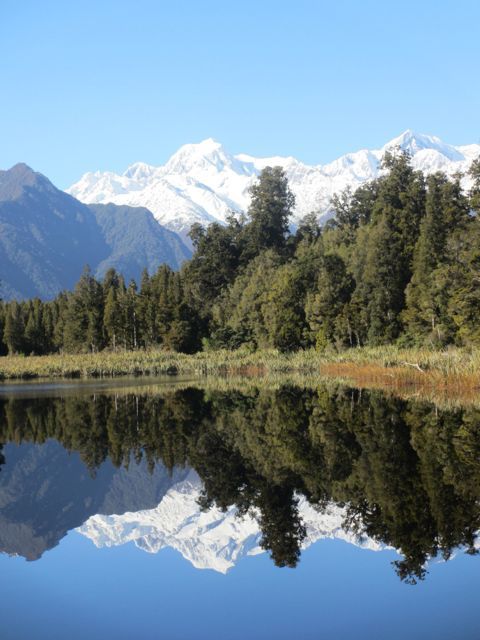
I drove south to Fox Glacier where we use to camp on the school trips I led in the early 70's. I went out to Lake Matheson. I did not remember it as being such a long walk from the road. However the views were well worthwhile. New Zealand's highest mountain Aoraki (Mount Cook) is in the 2nd view.

I took a quick look at Fox Glacier, also much smaller than in 1973.

Then I drove further south to Knight's Point.

There was a monument to the opening of the road and I discovered I first drove along it (in a bus) just a year after it opened in 1965.
After lunch in a hotel at Haast, I headed over the Haast Pass. It is lower than Arthurs Pass. Here is a view of the Haast River valley.

The Pass is only open from 8am to 4pm since the terrible landslide that killed 2 tourists last year. I was held up for about 15 minutes at one spot where the repair is continuing.
As I reached Lake Hawea, the shadows were lengthening.

I stayed the night in Wanaka. I had pre-booked the motel as it was Saturday night and Wanaka is in a ski area. Otherwise I would have stayed longer on the coast after being delayed on Arthurs Pass. I will have to return.
Sunday morning, I took some photos of Lake Wanaka from the town. All my previous visits have been in summer.


Then I drove home across Central Otago. This view was taken from the road as I approached Ranfurly about 125 km from home but much closer as the crow flies.

I could still see snow on the Rock and Pillar Range not far west of me when I looked yesterday but we had another snowfall just a week ago after I arrived home

No comments:
Post a Comment